Climate Resiliency
Communities that were deeply affected by Superstorm Sandy had a long rebuilding process after the floods. Years later, they are still preparing for future storms.
Going Dutch
How New York plans to prepare its coastlines for climate change
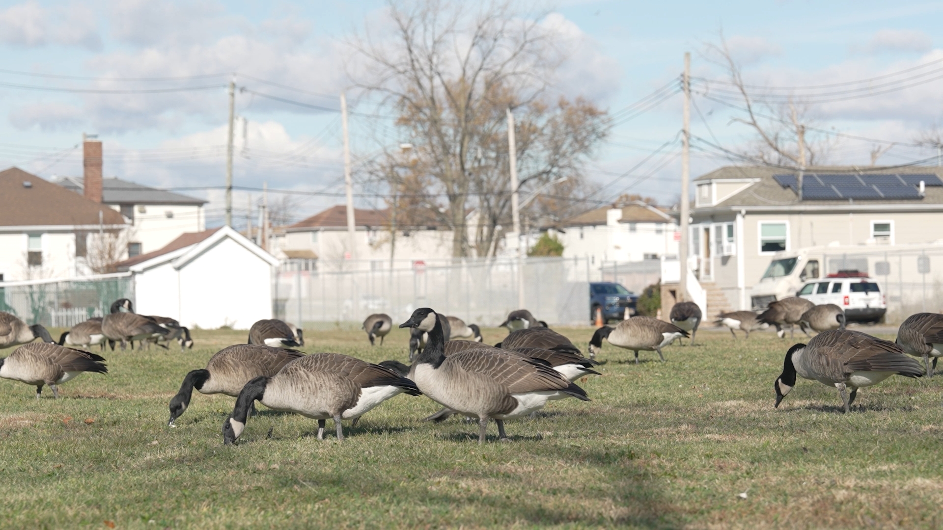
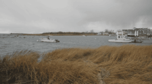
“Climate change! I thought these wide paths were just here so we can bike and walk around without being stopped by a homeless person,” said Raj Suresh, a resident of the Financial District. This was his perplexed reaction to learning that the newly renovated Battery Park was constructed not only as a place of leisure but also as a mitigating force for flooding and sea level rise.
This is a reality for many New Yorkers: the changes you see in the city’s landscape are not meant to make abrupt, aggressive alterations to the urban landscape but rather to create an ability for people to live along the water long-term.
In 2012, Hurricane Sandy changed much of the fundamental view regarding the threat of New York’s waterways, rivers and seas to its livelihood. “The damage was so extensive and expansive, and covered a wide range. No boroughs were spared,” said Carter Craft, a member of the Waterfront Alliance and an urban planner for more than 25 years.
Craft has worked to fortify New York’s waterfront, his office at the Netherlands Embassy a testament to the lessons New York must now learn from the Dutch. The embassy is a modern office in the heart of Midtown, shelves lining the first floor with countless books and studies on water technology, a vivid example of the global impacts of this vital issue.
Although the Dutch have been at the forefront of water technology engineering, combating flooding for hundreds of years, it was Sandy that was New York City’s wake-up call. One reason was the loss of economic activity. Along with the devastation to families and residents, the city lost an exorbitant amount of capital.
“One hundred sixty-plus billion in economic impacts. And then related to that, the number was around $60 billion just for the damage to rebuild,” Craft said. This was partially due to the fact that Wall Street, the financial capital of the most economically powerful metropolis in the world, remained virtually dark for two weeks and officially completely closed for two days straight.
Unfortunate as it is, the economic catastrophe surrounding Sandy was a chief catalyst for a need to fortify Manhattan. The issue was that New York City, in general, was lagging behind. The city had not planned out a strategy, nor had it allocated the resources or infrastructure necessary to completely devise brand-new solutions. Luckily, New York had other global examples to follow.
“We have been dealing with water for hundreds of years. You look at places like The Hague, which have been successful despite being feet below sea level,” said Carola Hein, director of the Leiden-Delft-Erasmus PortCityFutures Centre in the Netherlands. Hein was recently in New York City for the AIVP conference, a meeting place to share ideas and technologies to deal with impending threats of sea level rise. “Living with the water is what we call it,” Hein said about the Dutch strategy of dealing with their coastal waters.
With New York having done little to address its climate concerns, global collaboration was instrumental in constructing a resilience strategy. In the Netherlands, the strategy of “living with the water” actually involves bringing rising sea levels into the cities themselves. Cities like Rotterdam and The Hague utilize areas that are not inhabited, like old factory sites and abandoned villages, and redevelop these places into public space. In times of flooding, water is redirected into these areas.
Additionally, canals, plains, basins and rivers are used to redirect rising water, completely changing the geography of entire parts of the country. In fact, by bringing some of the water in and redirecting some of the water out, an estimated 17% of the overall land mass of the country can be credited to their expertise in controlling their surrounding seas and rivers.
After seeing the devastation wrought by Sandy, the Dutch were one of the first to offer up their expertise. The reality, however, is that the model is not a one-size-fits-all. “We don’t have a lot of space to put the water. So they ended up with a design that elevated the park out of harm’s way,” Craft said. That is exactly what you see in the lower bounds of Manhattan.
Manhattan specifically is far too urbanized, with tall buildings just a few feet from the East and Hudson rivers. This meant the strategy required a hybrid approach. The key to fortifying Wall Street, the Financial District and Lower Manhattan as a whole would require a combination of both old strategies, as well as new approaches that would make the most sense for New York. One could call it “living with the water on steroids.”
Robert Wagner Park is a perfect microcosm for the overall strategy: seawalls, elevated ground levels, buried sea barriers and exorbitant green space all meant to fortify Lower Manhattan.
The planning was not seamless. Years of preparation and community collaboration were required to actually develop an actual strategy. Multiple options were proposed, but approval was finally granted for the new developments at Battery, Robert Wagner and East Village Park. Finally, in 2025, these developments on the parks were completed.
On Nov. 12, 2025, at an event in Greenwich Village a collection of architects met at the AIA Center for Architecture to show off their either completed or in-progress prototypes. When asked about the future of these initiatives at a global scale, the group was focused on domestic challenges. “These prototypes are approved by FEMA and the Army Corps of Engineers, meaning they can be replicated in other locations,” said Matthew Potter, one of the lead architects on the panel.
For Hein, the issue of flood resilience is not just one of engineering or design necessity but also takes on a psychological dimension for residents across the world. “Jakarta is an example where they are moving half of the city and relocating the people. So what does that mean? We have long placed poor people in low-lying flood-prone areas. This is a conversation for everyone on how we plan our cities.”
That is the reality on the ground as well. Not everything will be made as easy as the Dutch approach in the Netherlands. For them, the strategy of living with the water has been commonplace for hundreds of years. There is infrastructure, investment, innovation and an ideology of placing water concerns at the center of the political discourse.
For places like the United States, not only are our cities built without this concern for rising and unpredictable sea levels, but also we don’t have the same national will to act. The culture will have to change.
Words like climate change, sea level rise and global warming all have been heavily politicized buzzwords, leading to battles and plenty of inaction. What countries like the Netherlands show us is that this reaction is misguided. For Carter Craft, this means a societal shift. “I think in this country, we really need to find ways and patience to take the longer view, because realizing these longer-term solutions for our safety, for our economic productivity, for our life and livelihoods takes a long time. So we got to find the ways to be patient and not just rush to rebuild every time a disaster strikes,” he said.
Until then, we will have to get used to people like Raj Suresh. “What if the water goes over these walls. We are all going to just drown in here?”
The Return of East River Park
Locals ready themselves for a new era of resiliency
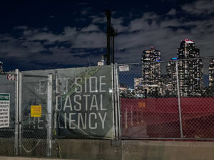
As part of the East Side Coastal Resiliency project, the previous park was destroyed and the city built it up on top of eight to 10 feet of dirt
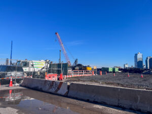
Nearly four years after closing for a sweeping revamp, East River Park is expected to fully reopen to the public next year, marking major progress for the city’s East River Coastal Resiliency Project.
The project has been unfolding in two phases, elevating the park’s southern and northern sections. The southern portion is nearly finished and already open to the public, while construction on the northern end continues.
Why Elevation?
In 2012, Superstorm Sandy struck the East Coast of the United States. In New York City alone, 44 people died and the storm caused $19 billion in damages. The city then realized it needed to prepare for intense coastal storm surges in the future, especially with sea levels projected to rise over the next 25 years.
In 2013, the city launched a design competition called Rebuild by Design that invited proposals from architectural firms. One of the proposals was the Big U, which covered the southern tip of Manhattan in a U shape to recreate a park that would also serve as flood infrastructure.
“The design was led by a Danish architecture firm called Big. Bjarke Ingels is the principal there. After they came up with the design, they started to do it in parts on the lower east side. The idea was to make a floodable park… A Dutch-style formula of flood protection,” said Malcolm Aaros, professor of sociology and public service at NYU’s Wagner Graduate School.
That was the plan originally agreed upon by the designers and planners. But when the city began evaluating how feasible it would be to actually build it, they realized it wasn’t doable for several reasons, he said, adding that one major issue was the utility lines running beneath the park.
Officials also opposed a floodable-park design because it would require major cleanup after every storm. Instead, the city introduced an entirely different proposal — elevating the park by roughly 8 to 10 feet.
The community was disappointed by the shift in plans — the earlier approach had been participatory, democratic, and radically inclusive. Still, many ultimately favored moving forward with a flood-protection plan, according to Aaros.
But there was another group of environmentalists who were against the destruction of this park, trees, vegetation and the animal habitat. One such prominent environmental advocate was Pat Arnow, co-founder of East River Park Action (ERPA), a group formed in 2018 to oppose the plan to fully demolish the park and to push for a more effective flood-control alternative.
“If you’re trying to deal with climate change, maybe you need to do projects that are properly resilient,” Arnow said. “You need to pay attention to what kind of resources you put into your flood control. Is it all concrete? Is it artificial turf? Are little saplings replacing mature trees? Well, that’s not environmentally sound. That’s not a good way to deal with climate change.”
ERPA organized numerous demonstrations and press conferences against the park’s demolition but ultimately lost in court. In response to sustained community pressure — including from ERPA and other neighborhood groups — the city adopted a phased-construction plan that kept part of the park open during the work. The demolition and reconstruction began in late 2021.
But even with the revised plan, many residents felt the city was ignoring the park’s ecological value. “They (trees) were over 80-years-old. And they did very well under adverse circumstances… Some of the park would have had to be destroyed, but they could have simply built a wall along. And we wouldn’t have had to destroy so much of the existing biodiversity, the trees, the playgrounds, and have a park that was closed for so long,” said Arnow.
She is glad to see the part of the park reopen, but she still voices concerns about several issues — including the use of artificial turf. “After a rain, you’ll see the little artificial turf beads going out into the river where they can contaminate the East River and the whole harbor.”
One of the fears people have is that the rebuilt park will bring about displacement. “They promise that the residents will get new apartments. But it is probably going to lead to more and more displacement of the people who already live here.”
The second phase of the project is expected to wrap up by end of 2026
Fixing the Northern Section
The same approach used to elevate the southern section is now being applied to the northern side of the park – its construction should wrap by the end of next year. The previous park was destroyed and the city built it up on top of eight to 10 feet of dirt. “That’s the model they used… nothing too technical, just raised it. They also built a flood wall, which involves some complex engineering challenges,” said Aaros.
He explained that funding from the federal, state, or city governments isn’t sufficient to cover these costly initiatives. “These are very expensive projects, and it’s not enough money to fund them. So we’ve seen a lot of smaller projects for climate resilience, but it’s unknown.”
He argued that few historic, densely built neighborhoods have ever been reshaped so extensively for climate change, and that cities worldwide have been slow to act. “I think there was no precedent anywhere of such a dense kind of historically built up, urban area that then was massively transforming itself in response to future climate change since that happened.”
The construction disrupted animal life, including squirrels and migratory birds that use the park as a stopover. “Even now, there are fights about what’s going to happen with the squirrels that live there and the birds like migratory birds,” Aaros said, adding that city officials have acknowledged this and are planning to increase plantings to help restore greenery and habitat after construction.
The Lower East Side Ecology Center, which has long operated in East River Park, now stands abandoned in the southern section as construction of a new facility gets underway in the same area. A construction worker expressed doubt about whether the project would be completed on schedule. “The other side (southern) is open, but we’re still working here,” he said, referring to the new facility.
People Speak
The public had mixed reactions — some were delighted that the park was reopening, while nearby residents expressed frustration over ongoing construction on the northern side, citing noise and pollution.
“We missed the park a lot. It was closed for about four years. We missed being around the waters, the green spaces. We are happy it’s open. We are enjoying the new playgrounds and the fields. They did a very good job and it was necessary,” said Sarah Jirari, 32, a counselor. “It was hard with all the construction and the noise. We are still getting lots of noise while they are renovating other parts of the park.”
“We did like the old park. There was a lot of shade,” she added. “It was seclusive. This one is very open and looks more modern but sometimes you miss the old park.”
Phong Thai, 61, who lives in Queens and works as a podiatrist in the Lower East Side, said she is excited for the new park. “I usually try to take a walk during my lunch break here (at the park). This park really represents New York. I love it.”
“I can’t wait for them to open (the other side) because I used to run down there because that’s closer to me.”
For Marcos Perez, a Lower East Side Resident, the new park “is definitely more spacious, more beautiful… it gives out more energy for everybody, for children, for grown adults”.
Red Tape in Red Hook
A neighborhood strains to ready for the threat of climate change
Red Hook exists on borrowed land—territory that originally belonged to the New York Harbor. The industrial Brooklyn neighborhood is built on landfill over what was originally marshland feeding into the Buttermilk Channel. When Superstorm Sandy hit in October 2012, Red Hook was underwater once again, the ocean reaching out and grabbing at what it once lost.
In the years after, the community rebuilt and the city worked with specialists to plan for future storms. In September 2025, nearly 13 years after Sandy, New York City broke ground on the Red Hook Coastal Resiliency project, giving fresh attention to a stale problem. The highlight of the $218 million project is 1.5 miles of flood defense structures, in some places including five-feet high walls, which, combined with features such as raising street level, will create flood protection up to ten feet above sea level.
But Dr. Klaus Jacob, Doherty Senior Scholar at the Lamont-Doherty Earth Observatory of Columbia University, argues this is not enough. “If they are of the opinion that Red Hook is not sustainable, then it is intentional to only put a temporary fix.”
Activists and residents say that the city’s resiliency efforts in Red Hook are insufficient to protect the area from flood risk. After over a decade of recovery and city planning from Superstorm Sandy, some feel that the Red Hook Coastal Resiliency project is misguided, and even dangerous. They are wondering how, after 13 years, the city arrived at this plan.
Victoria Alexander has been involved with the city’s resiliency efforts from the beginning, not only through her work for Resilient Red Hook, a grassroots group in the neighborhood of which she is interim chair, but also because she lost everything during Sandy. Alexander has lived in Red Hook for over twenty years, and the 2012 storm left her homeless for six months.
She describes the recovery period as a combination of the community coming together and emotional rebuilding from the immense personal losses. Alexander says the city was initially very receptive to community input on the Red Hook Coastal Resiliency project, originally called the Red Hook Integrated Flood Protection System. However, she says in recent years the engagement with the community has dipped.
“It’s a short-term fix for a long-term problem, and a rapidly-evolving problem,” says Alexander. She says the five-foot wall is not enough to stop the neighborhood from flooding. Not only that, but once the water gets in, it will be stuck behind the wall, creating a “bath tub.” During Sandy, the water came in, flooding much of the neighborhood, but then receded (except for places like basements where the community pumped it out). However, with RHCR’s additions, in the event of a storm surge over the floodwall, the perimeter of barriers will actually trap the water in the neighborhood.
The New York City Panel on Climate Change first asked Dr. Jacob to join in 2008, and he was involved in building quantitative forecasts for climate change in the Tri-State area. There, he focused on the scientific implications of the city’s urban planning relative to projections of climate risks. In his opinion, the city has lacked a comprehensive view on urban planning over the years, both spatially and temporally. “The longer we delay a comprehensive approach, the more expensive it will be because we will have a compressed timeline,” says Dr. Jacob.
Dr. Jacob says the construction of 10 feet of flood protection is, at most, a short-term fix. He wrote for the City Club of New York that any flood-prevention projects below 14 feet NAVD88 (North American Vertical Datum of 1988) are insufficient. With rising sea levels, the storm surges of even more statistically-frequent weather events are getting higher. That is, as time progresses, the surges expected for 10-, 20-, 50-, and 100-year storms are all increasing. (A 10-year storm is one that has a 1 in 10 chance of occurring in any given year, and so on.) Ten feet of protection for Red Hook, Dr. Jacob argues, will not buy the neighborhood much time as storms surges continue to grow in height.
As to why the city chose to go with the 10-foot protection now in 2025, Dr. Jacob sees two possibilities. First, the city may have chosen now to do the project in order to say they did something to protect the neighborhood. Second, the city may believe that Red Hook is uninhabitable in the medium and long term, in which case the ten feet of protection—a short-term solution—is intentional. That is, if the city does not envision people living in Red Hook for decades to come, the goal of RHCR would only be protection until the point it is unlivable.
And yet, the city is also moving forward with a plan to reshape the Brooklyn Marine Terminal (BMT) in and around Red Hook. A Task Force made up of elected officials, agency representatives, industry experts, and community organizers voted to approve the BMT Vision Plan in September 2025.
Led by the NYC Economic Development Corporation, the BMT plan promises 6,000 new units of housing, parks, and a fully-electrified port to integrate into Blue Highways, a mission to use New York City’s waterways to reduce truck traffic. This long-term investment in Red Hook is seen by some as a win for commercial developers who have long eyed the Brooklyn waterfront for luxury housing.
One of the selling points for the affirmative vote on the BMT Vision Plan was that it guarantees 40% of new housing in the plan will consist of permanently affordable units. However, the definition of what is affordable has sparked outcry in the community.
The plan states that these affordable units must be priced at no more than 60% of the area median income (AMI), with at least a tenth of the units no more than 40% of the AMI. Alexander says this is still too high to be considered truly affordable for many New Yorkers. Currently, half of Red Hook’s population lives in the Red Hook Houses, publicly subsidized housing complexes, which were flooded during Hurricane Sandy.
According to the 2024 NYC Neighborhood 360º Commercial District Needs Assessment, the median household income in Red Hook is less than half of that of Brooklyn, at $36,727 compared to $74,692, with 35% of Red Hook’s population living under the poverty line. The median household income in Red Hook is therefore below 40% of AMI according to the NYC Department of Housing Preservation and Development. The question remains how Red Hook’s low-income population fits into the BMT Vision Plan.
Yet, even beyond pure affordability, there are additional questions of equity in the city’s approach to development in Red Hook. Summer Sandoval, a volunteer supporting Resilient Red Hook and Voices of the Waterfront, a community group concerned about BMT, notes that not only is “affordable housing” a “loose label,” but questions whether building such housing in a floodplain is reasonable. Dr. Jacob shares similar concerns, saying that, while the city has come to a consensus on a housing shortage, it has yet to reckon with the idea of a “safe housing” shortage.
He adds that the current plans for both RHCR and BMT reinforce existing inequities. The reimagined BMT will feature flood-prevention infrastructure for its new housing developments, which will be at a higher elevation than for the surrounding area. Dr. Jacobs says the low-income residents, such as those in Red Hook Houses, will be stuck with the inadequate ten-foot protections, while the new developments are planned to have more comprehensive safeguards.
Sandoval is helping to organize input into the BMT scope of work, which outlines these plans for flood prevention “tailored for the new infrastructure.” Though she is not a resident of Red Hook, Sandoval believes in the importance of empowering community members to share their concerns and meaningfully participate in urban planning processes. Alexander, as part of the Voice of the Waterfront steering committee, is mobilizing community members to provide written feedback on the scope of work to ask for more flood protection measures that will also help the surrounding area.
With the election of Zohran Mamdani as the next mayor of New York City, Dr. Jacob sees a renewed opportunity for residents of Red Hook to organize in favor of comprehensive planning. Because of the transition between administrations, activists have a chance to build a coalition pushing for long-term flood resiliency and safe housing across the city. Dr. Jacob says that higher floodwalls require more horizontal space, which displaces existing housing and businesses. For that reason, he says long-term resiliency is only possible with comprehensive planning and buy-in from the community. For him, neither RHCR or BMT come close to solving the problem.
Still, there is hope that community organizing can create stronger political will. “It needs strong leadership with grass roots in environmental justice. We all sit in the same boat, so we have to move together a little bit,” says Dr. Jacob.
The city’s community construction liaison for the Red Hook Coastal Resiliency project did not respond to request for comment.
After the Superstorm
Life in Queens in the long aftermath of Hurricane Sandy
When Hurricane Sandy hit New York City on October 29th, 2012, nobody in Queens, and particularly along coastal communities such as Hamilton Beach, Rockaway, or Jamaica Bay, could imagine the magnitude of the devastation.
The consequences of Hurricane Sandy were far more devastating than any other hurricane that had struck Long Island, New York, and New Jersey. In addition to causing significant damage, Sandy ranks among the top ten costliest hurricanes in the United States in terms of economic losses. The critical infrastructure of New York City, including the subways and the power grid, was severely compromised, with service disruptions lasting several days. The communities along the coast of Queens and Brooklyn were among the hardest hit, but the neighborhoods of the Rockaways, Gerritsen Beach, and Manhattan Beach were particularly devastated.
In many areas, a massive amount of sand was pushed up by the waves, invading the streets and forming a barrier up to ten feet high, covering numerous buildings and properties just a few blocks from the beach. In particular, people living in residential high-rises in the Rockaways were trapped in their homes for days without the ability to leave. These neighborhoods, primarily made up of middle and working-class families, faced enormous difficulties for days due to the lack of essential services or medical aid.
“They couldn’t get out because the elevators didn’t work. There was no electricity. There was no hot water in the building. Some of them had chronic medical problems, and they couldn’t get out to get medicine or get to doctors,” said David Abramson, Clinical Professor at the NYU School of Global Public Health and director of PiR2, the population impact, recovery and resilience research program. “It required an enormous effort just to address the needs of the people in those buildings.”
Thirteen years have passed since October 29, 2012, but, as often happens with natural disasters of this scale, the consequences remain visible even many years later. Despite the fear, the residents of Queens have learned to live with the awareness that, if another environmental emergency were to strike, their area would be one of the most vulnerable. According to an analysis on mortality following Superstorm Sandy published by Abramson, it was found that in New York City – though with variations across neighborhoods – the mortality rate increased by three to five percent, as did the rate of cardiovascular incidents.
However, physical trauma is only one part of the story. Abramson underlines how Sandy has altered the lifestyles of entire communities: “I think more than anything, what happens is that storms like this push people off the trajectory they are on. You are living your life, you think your life is heading in one direction, and then all of a sudden this major event occurs and you end up living an entirely different life than you had planned. Some people end up living a life that they did not really want, and it has long-term implications for them.”
Hamilton Beach/Howard Beach High Tide Pictures Facebook Group, “164th Ave”, photo by Bruce Bubba Stock
The echo of Sandy is still visible today in the increasingly frequent floods, serving as a reminder to citizens that climate change is a systemic phenomenon that requires large-scale actions and protection plans and, despite ongoing state efforts and existing projects, Queens is still not adequately prepared to contain its effects.
In Hamilton Beach, Roger Gendron, president of the local civic association, has witnessed the transformation of his community over the last decade.
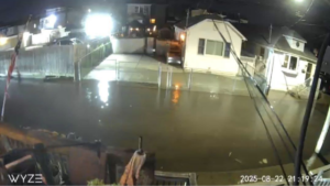
“We always had some flooding; as kids it was something new. But as a homeowner, the first significant high tide brought eighteen inches of water into the ground floor. It was a wake-up call.”
Over the following years, the situation worsened. “In 2018 we had coastal flooding almost every three weeks. I created the Facebook group to collect photos and precise information, so now we can show concrete data to the officials. I don’t think it was that they were ignoring us. It’s just that we didn’t have the ability to prove it to them. So it was our word against theirs. And now it’s not. It is their own data against them.”
Gendron notes that Sandy opened the eyes of just about everyone in his community. “High tide on the streets has steadily increased over the last 10 to 15 years. Some months we see streets flooded one or two days each month. It disrupts so many lives. Getting out to work, getting your kids to school, getting home from work, getting home from school, having deliveries, going to the doctor.”
Despite these warning signs, Gendron believes that infrastructure preparedness remains insufficient. “If my neighborhood experiences another Sandy, we will see the same exact damage. Some houses will not. My house has been rebuilt after Sandy. Several other houses were elevated, but not everyone’s. So if Sandy hit again, the same houses that were not elevated would get the same four feet of water through their living space.”
The city’s response has evolved in the years since, thanks in part to the work of the New York City Department of Environmental Protection. Douglas Auer of the DEP emphasizes that in Southeast Queens the agency is carrying out a multi-decade, 2.78-billion-dollar program to build a complete and durable sewer system. Over the past 10 years, more than $1.5 billion has been invested in projects, some still in the planning stages and others already completed. Among the most complex is the triple-barrel under Idlewild Park, which, according to Auer, is comparable in scale to a subway line.
Citywide, the DEP has a $9 billion plan to upgrade sewers, reduce storm flooding, and make the city more resilient. Both traditional and nature-based solutions are being implemented, including the Bluebelt network, rain gardens, and permeable pavement. Recent town halls in the city distributed flood-protection kits with barriers, pumps and alarm sensors, increasing residents’ awareness.
The DEP is also working on Cloudburst projects to manage intense sudden rainfall. One example is the system built at the South Jamaica Houses. Stormwater is collected and stored beneath basketball courts, then drained gradually into bio-retention basins, a system that can manage up to 3.5 million gallons of water every year.
Broad Channel Landscape
Other interventions include the creation of green medians in Arverne and Queens Village, the construction of bulkheads to reduce tidal flooding, and raising streets in Broad Channel with projects worth 46 and 51 million dollars.
Even in small communities like the Rockaways, local initiatives have taken on a central role.
“After Sandy, technically, FEMA was supposed to help them fix their damaged homes,” said Julie Anne Alfeche, the Public Programs Coordinator of RISE (Rockaway Initiative for Sustainability and Equity). “But a lot of that didn’t happen. So to this day, especially if they have a basement, it is not usable. Residents’ awareness has grown. They want to do something to prevent future damage, knowing that climate change will make these events more frequent.”
The Rockaway Coastal Resilience Plan includes reinforcing dunes along thirteen miles of coastline, in combination with existing seawalls. “We build secondary dunes, plant native grasses, shrubs and trees to create complex root systems that anchor the sand and mitigate storm surges. We also organize volunteer sessions. In spring and fall more than eighty people participated in planting thousands of plants.”
This community participation strengthens the sense of resilience and helps residents feel part of the solution, not just victims of climate events.
Despite the progress, Abramson said that New York might not be completely ready for another Sandy. “We are slightly more ready than we were the last time. I think that the city is probably better at appreciating forecast and model data, and I hope they would be more aggressive about positioning assets and resources closer to where the impact would be. They also redid the evacuation maps as a result of Sandy, which is an improvement. But in other respects, things would be much the same.”
Gendron also believes the reality for coastal communities remains tough. “We abandoned our first war years ago. The best that we can hope for is to inform people. We cannot make anybody do anything to their own home. We can give them suggestions. I have suggested purchasing products like Damn Easy that you can place inside your door. You inflate a bladder, use a ratchet, and it expands to create a barrier at your doorway.”

Broad Channel, November 2025
For Afleche, the key is preventive preparation. “We have strategic emergency plans to let people know immediately what to do. The community is very involved. Volunteering, planting, caring for the habitat. Without them, the projects would not have been successful.”
The story of Queens, Hamilton Beach, Howard Beach and Rockaway demonstrates that climate change is no longer abstract; it is tangible. High tides, increasingly frequent and intense storms, and the social and economic impact on the community require complex solutions such as infrastructure, community preparedness and concrete political action. As Abramson said, storms push people off their expected life path.
Residents continue to monitor tides, document flooding and prepare their homes, yet the challenges remain enormous. “It’s so important to actually do something beforehand, you know, instead of just reacting afterwards, do something proactive to try and lessen the chances of devastation like the last time,” said Alfeche.
In the Hole
Is one of New York’s most unique neighborhoods disappearing for good?
The Hole suffered from flooding for decades
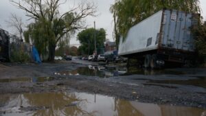
On a humid fall afternoon, puddles filled cracked pavement, stretching like shallow ponds across driveways. The water hadn’t come from a storm. It was simply there, as it often is in The Hole. A black pickup rolled through slowly, the wheels making ripples in the puddles.
For residents of this tiny enclave on the border of Brooklyn and Queens, it is a routine day. Flooding here is not an event; it is a condition.
In The Hole, septic tanks back up when it rains. Pumps hum overnight to keep wastewater from rising. The houses sit lower than the surrounding city, and that’s where the water goes.
In October 2025, after more than two decades of debate and abandoned proposals, the New York City Department of Housing Preservation and Development announced the Jewel Streets Neighborhood Plan, a redevelopment initiative aimed at fixing the area’s chronic flooding problems. The plan calls for sewer installation, street elevation, drainage upgrades, and a buyout/retrofit program for homeowners. Constructions of affordable housing were planned. For many residents, the announcement finally felt like progress after years of silence.
“The most important thing is the budget. It’s approved. Finally, it’s going to happen,” said Tomas Mora, a longtime resident.
The Hole is the unofficial name of a low-lying cluster of small detached homes, many built decades ago without modern infrastructure. Sitting near East New York, Brooklyn and historically isolated, the neighborhood lacks a formal sewer system; most houses rely on cesspools. When storms hit, water has nowhere to go. During major floods, residents wade through brown water that can sit in streets for days.
In recent meetings, officials described the plan as a long-term effort to improve quality of life and reduce flood risk. But in The Hole, belief is earned, not given. Many residents say they are cautiously hopeful.